
United States 1851 Hand Colored Map
London & New York: John Tallis, 1851.
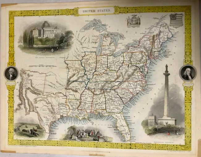
Map. Map. Approx. 11" x 14". Map covers Santa Fe north through the Missouri Territory to Canada and east to the Atlantic. Undated but recorded 1851. Removed from the "The Illustrated Atlas, and Modern History of the World. Geographical, Political, Commercial & Statistical". Martin (R. Montgomery), editor and John Tallis: Published by London; John Tallis & Company, 1851. Some remnants of tape residue at 5 spots on the extreme edges. Folded once. Map is illustrated with small portraits of Washington and Franklin, color vignettes of the Washington Monument, Capitol, a buffalo hunt, and a pioneer scene. West Virginia, which became a State during the Civil War, is not shown on this map. The Western Territory area is roughly the location of Oklahoma. The boundaries are not set for Iowa and Wisconsin. The New Mexico Territory, created in 1850, followed acquisition of upper California in the 1848 Treaty of Guadalupe Hildago ending the Mexican War. This 1851 map does not show the New Mexico extension. Very good. Item #22634
Price: $350.00